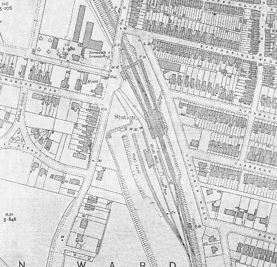
Gorleston-on-Sea Station - Ordnance Survey Map, 1:2500
(1927)
Note the extensive sidings with the Goods shed, coal yard and cattle pen. The positions of the footbridge (FB) and signalbox (SB) can also be seen in this view.