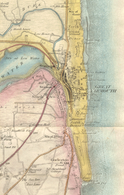
| Note how little development
has taken place with everything localised around the Haven and quay areas.
The large number of rows can also be made out on the map. South Denes is
still rural and is dominated by the race course and Nelson's column is standing
in isolation. Gorleston is even less developed and the present day suburb
of Bradwell is still a village.
The Norwich & Yarmouth Railway station at Vauxhall and the East Suffolk
Railway station at Southtown can be seen but there are no rail connections
between them. The Beach station does not appear as it didn't open until
1877.
|


