
 |
 |
||||||||
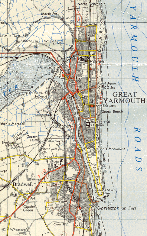
| Great Yarmouth - Ordnance Survey Map, 1 inch to 1 mile(1960) | ||||
 |
||||
|
Reproduced by kind permission of Ordnance Survey. © Crown Copyright NC/02/3723. Development really starts to take hold now that the war is over. Gorleston has expanded rapidly towards Bradwell which begins to feel its effects. Crab Lane is present together with the Magdelen and Shrublands estates. The Southtown, Cobholm and Newtown areas have also seen significant growth. The line to Lowestoft remains open but the M&GN line is a casualty of cuts and Yarmouth Beach station and Yarmouth Newtown halt are indicated as closed. |
||||