
 |
 |
||||||||
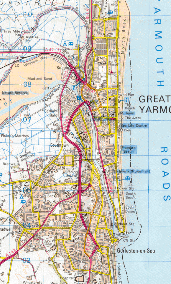
| Great Yarmouth - Ordnance Survey Map, 1:50000(1997) | ||||
 |
||||
|
Reproduced by kind permission of Ordnance Survey. © Crown Copyright NC/02/3723. The most significant development shown is the new Gorleston and Great Yarmouth Inner Relief Road which follows the route of the old Yarmouth to Lowestoft railway line. At its southern end the easternmost roundabout is built on the site once occupied by Gorleston-on-Sea station. Bradwell and Gorleston have now almost become one following construction of the new housing estates off Beccles Road and this infilling has continued with more building at the Harfreys and Gapton Hall trading estates together with the link road connecting the Inner Relief Road with Burgh Road.
|
||||